The Loveland Blog

Renewable Energy - Informed decisions & faster time to market with Landgrid Parcel Data

By Sahana Murthy on February 5, 2021 · Field Studies

(Photo by Tyler Casey on Unsplash)
 
There is a clean energy revolution happening across the globe right now, with Wind & Solar leading the bandwagon for a better, cleaner & a more sustainable future. Sustainable energy generates billions in economic value and is expected to continue growing at a rapid pace in the coming years.

More states and cities are expected to increase their decarbonization efforts and more companies are investing in green hydrogen production and storage products. 

What does this mean for businesses operating in renewable energy - more demand, quick data-driven decisions and faster time to market. Let Loveland be that data partner for you!


Informed decisions using high-quality, standardized parcel data:

  • Data driven site selection - Nationwide, standardized, accurate parcel boundaries, acreage, ownership, address (situs & mailing) and standardized land-use codes give you everything you need to make informed decisions faster. 
  • Nationwide standardized land-use codes to expedite your decisions - Parcel data is fundamental to decision making, no matter the size & scale of the project. As we say in Loveland technologies, we are all sitting, standing or walking on a parcel for most part of our day. That said, there is more to our parcel data than just parcel information, tax assessment data and shapes (boundaries). Combining standardized parcel data with nuanced & granular land use codes across the country is invaluable.
Let Loveland’s nationwide standardized land used code (Land Based Classification System - LBCS) attributes help you further in your site selection process.
 
Whether it is about understanding the activity of a parcel (Eg - Residential LBCS code - 1000, Industrial, manufacturing, and waste-related activities - 3000 etc) or to dig deep into the characteristics of the site itself using LBCS_Site (Site that is graded with no structures or active use or Developing site or Developed site with roads, train tracks, and other linear structures or Developed site with tanks, reservoirs, etc), we’ve got you covered.
 
(Pic - Recently released land along the US-Mexico Border Project using our LBCS codes) 
 
  • Universal key for disparate data sources - As fundamental as parcel data is, renewable energy companies will need several other data sources - water lines, geothermal, infrastructure, energy & power grids etc. Let us help you join disparate data sources with our parcel data using matched Placekeys.
Loveland Technologies is one of the founding partners of the Placekey Initiative- the universal location identifier for any physical place in the world. Loveland can append matched placekeys to our parcel data making it easy for you to join parcel information with other data sources. Essentially making the data ingestion & ETL process faster at your end.

Faster time to market with a singular turn key solution - Landgrid Parcel Data!

  1. Landgrid Parcel Data - Standardized nationwide data - ~150 M parcel boundaries with over 110 tax assessment & contextual derivative columns, available in multiple formats & delivered as bulk files for download and/or API to meet your every need.
  
 
  1. Landgrid Mapping Platform - Parcel data viewer loaded with parcel prospecting (surveying) capabilities through an parcels-on-the-go mobile app for an expedited, data-driven site selection process.
 
  1. Premium contextual columns Access our deeper, contextual derivative columns, which are part of our premium data tier:
  1. Buildings Footprints for your solar projects - Coming soon - Loveland will be able to provide >156 M building footprints matched against our parcel data in addition to our dataset for your solar projects. We are the one-stop shop for all things parcel & land data. :)

All this at an affordable price.

Like we said, ONE Turn-Key solution for your clean energy projects in 2021.

Email us today at parcels@landgrid.com to get a data sample!

Landgrid Participation in Coronavirus/COVID-19 Research

By Sahana Murthy on March 16, 2020 · Field Studies

As we're all aware, COVID-19 cases are on the rise. During these uncertain times, we all have to do our bit to contain the situation. 

As a fully remote & distributed team, each one of our Lovelandians is working safely from their homes. However, we want to help out more. 

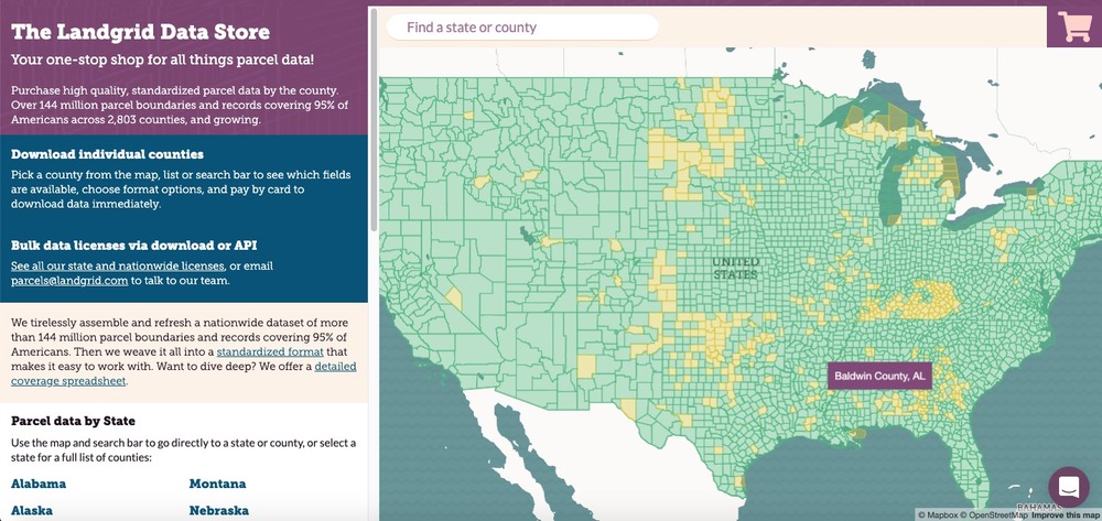
We want to help & participate in the COVID research in any way possible. We have a nationwide, comprehensive dataset of 144 million parcels. While, parcel data may not be directly associated with medical research we do believe it can be useful for certain Coronavirus or census related research. 

We want to offer our data to help with that. If you are a local government or a fellow mapping & data company that could use parcel data to push forward your study, outreach efforts & research on COVID-19, please contact the Landgrid team at team@landgrid.com.

Like I said, we all have to do our bit to help contain this situation - both at a personal & professional level.

Depending on the kind of analysis you are performing, our nationwide dataset of property shapes, addresses, ownership, buildings, and residential occupancy has immense utility in understanding populations and density at a much more granular level than a census tract or block.

If you are focusing on hyper local data for research, then please let us know. The Landgrid Data Store could be useful for local data assessments as well.


During this time of uncertainty, anxiety, and need, we’re all in on helping however we can.

Contact us at team@landgrid.com and we’ll figure out the best way to help you help others.